Corridors · Infrastructure · Systems
The Corridors
Passages, Permissions, and the Architecture of Movement
Power rarely begins where movement starts. It begins where movement can be permitted, redirected, or denied.

Before dawn, a container ship approaching the Red Sea receives new routing instructions.
Its destination remains unchanged. So does its cargo. The coastline has not moved, the shipping lane is still visible on every navigational chart, and no authority has formally declared the passage closed. Yet beyond the bridge, the conditions that made the voyage acceptable have begun to shift. An insurer has reassessed its exposure. Security advisers have revised their recommendations. The shipping company has recalculated the costs of fuel, delay, crew time, and legal responsibility.
By morning, the vessel may be turning south towards the Cape of Good Hope.
For those on board, the change appears operational: a new heading entered into the navigation system, another timetable transmitted ashore, another arrival date revised. The course has altered because the confidence on which the passage depended has weakened. The sea remains open in the physical sense while becoming less usable in the commercial one.
Much of the modern world moves in this way.
Globalisation is often imagined as a condition of openness: goods crossing borders, aircraft linking distant cities, energy flowing between producers and markets, data travelling almost instantly across continents. The image suggests a smooth and largely self-sustaining circulation. In reality, movement depends on arrangements that are neither automatic nor permanent. Every consequential route rests upon infrastructure and law, but also upon insurance, security, technical recognition, and institutions capable of maintaining trust across several jurisdictions at once.
What appears on a map as a line is rarely only a line. It is the visible trace of a much deeper order.
The world we recognise is divided into territories. The world through which trade, people, energy, and information actually move is organised through corridors.
That distinction exposes an architecture of power that territorial maps alone can no longer explain.
Corridors Before Geography
Maps invite a physical reading of movement.
A ship crosses a sea between two ports. An aircraft follows an arc across the sky. Oil moves through a pipeline. Data passes through a cable beneath the ocean. Because the route is visible, its importance appears to derive from geography alone: the narrowness of a strait, the position of a harbour, the distance between one market and another.
The arrangements surrounding the route are harder to see.
A navigational chart does not reveal the legal rights that permit passage through territorial waters. It does not show whether insurance remains valid in a conflict zone or whether customs systems can clear the cargo on arrival. Nor does it record the recognition of certificates across jurisdictions, or the point at which a security guarantee ceases to command confidence.
These arrangements belong to another geography, largely invisible on the map yet decisive in determining whether the route remains usable.
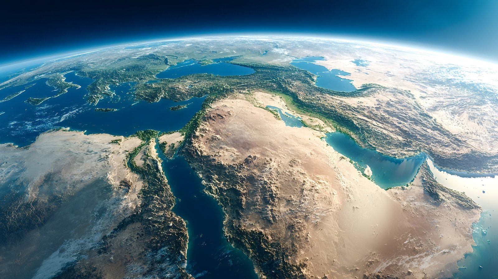
The Strait of Hormuz, the Suez Canal, and the Strait of Malacca make the distinction tangible. Each occupies a relatively narrow physical space. Each concentrates flows of strategic importance: energy, manufactured goods, food, industrial components, and the inputs on which production elsewhere depends.
Their significance is usually described through volume: the oil passing through Hormuz, the container traffic using Suez, the trade between East Asia, the Middle East, and Europe crossing Malacca.
Those figures matter. They do not, however, explain why these passages function as corridors rather than merely as stretches of water.
A commercial route acquires value when actors can rely on it. Shipowners must believe that vessels will pass without unacceptable danger. Insurers must remain willing to cover the voyage. Ports must be capable of receiving the cargo. Legal systems must provide enough certainty for contracts to be enforced. Naval and coastal authorities must preserve a minimum level of order. Financial institutions, often far from the water, must continue to support the transaction before the goods reach their destination.
When these conditions remain stable, the corridor appears almost natural. Ships move, schedules hold, and the institutional work required to sustain the passage recedes from view. The route becomes noticeable only when one of those conditions begins to fail.
A security crisis can alter risk calculations within hours. A diplomatic dispute can make a routine passage politically sensitive. A regulatory decision can delay or exclude particular operators. A change in insurance terms can turn a technically navigable route into a commercially irrational one.
The geography may be unchanged. The corridor is not.
Geography creates the possibility of passage. Institutions make that passage dependable enough to become infrastructure.
When the Route Remains but the Corridor Weakens
The disruption of commercial shipping in the Red Sea brought this distinction into view.
The Bab el-Mandeb did not narrow. The Suez Canal did not cease to exist. Vessels remained physically capable of crossing the route linking the Indian Ocean to the Mediterranean. Yet as attacks increased and uncertainty spread, shipping companies began to reconsider the passage.
The first changes took place far from the passage itself. Insurers revised their exposure. Security assessments were updated. Operators examined whether the commercial advantages of the shorter route still justified the danger. Some vessels continued. Others diverted around southern Africa, accepting longer journeys, higher fuel consumption, disrupted schedules, and the secondary effects created when ships and containers arrived later than planned.
No single institution closed the corridor. Its usability eroded through the interaction of many decisions.
This is a defining feature of contemporary infrastructure. A route can lose function without suffering physical destruction. It may remain legally open yet become too risky to insure, too expensive to operate, or too uncertain to integrate into a reliable schedule. Closure can be gradual, distributed, and unofficial, emerging from the behaviour of actors whose separate decisions begin to reinforce one another.
That form of disruption is easy to underestimate because it leaves the landscape intact. The port remains standing. The waterway is still navigable. The equipment may continue to operate. What disappears is confidence in the order surrounding it.
The result is an altered operational map.
Physical maps change slowly. Operational maps can change overnight.
The Sky as Allocated Space
The sea is not unique in this respect. Aviation reveals the same logic in a more explicit form.
To a passenger looking at a flight map, an international route appears to be a line chosen for efficiency. The aircraft follows the shortest safe path between two cities, adjusted for wind, weather, and traffic. Yet the route also reflects permissions accumulated through bilateral agreements, sovereign authorisations, technical coordination, and political consent.
The sky is not an empty space through which aircraft move freely. It is divided, regulated, monitored, and allocated.
An airline may possess the aircraft, the crew, the passengers, the fuel, and the commercial demand required for a flight, yet remain unable to operate the most efficient route. Access to airspace depends on sovereign authorisation. Landing rights depend on agreements between states. Safety oversight relies on the recognition of standards and certificates. Air traffic management requires cooperation between institutions whose relationship may extend little beyond the practical necessity of keeping aircraft safely separated.
The exclusion of many Western carriers from Russian airspace after the invasion of Ukraine showed how rapidly those permissions can reshape competition. The physical distance between Europe and East Asia did not change. The great-circle routes across northern Eurasia remained where they had always been. Yet carriers no longer enjoyed equal access to them.
Some airlines retained the ability to overfly Russia. Others were forced onto longer southern routings or withdrew from particular markets. Flight times increased. Fuel costs rose. Crew planning became more difficult. Aircraft productivity declined.
Continued access to the northern corridor created an advantage that no improvement in aircraft or engine performance could readily offset.
The episode reveals a second measure of distance.
Operational distance is measured in permissions as well as kilometres.
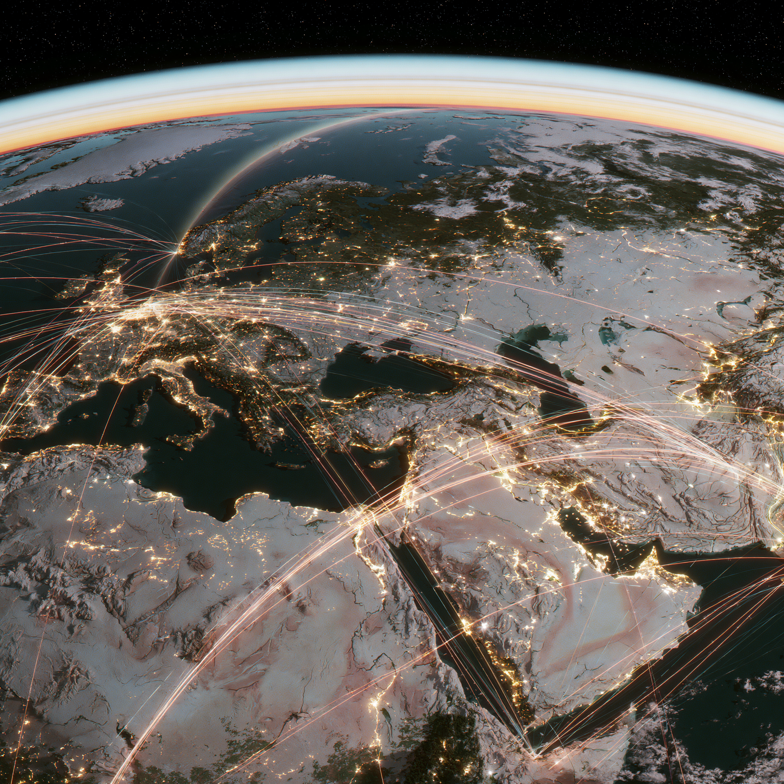
Two airlines may depart from comparable cities and serve the same market while operating across different geographies. One follows the shortest route geography permits. The other follows the route that politics leaves open.
The earth is shared. Access is not.
The Architecture Beneath Movement
No corridor operates in isolation.
A maritime route becomes valuable when a port connects it to inland transport and customs clearance, then carries the movement onward through warehousing, finance, and distribution. An airport matters because it links airspace to cities, labour markets, tourism, manufacturing, and onward connections. A pipeline depends upon extraction sites, pumping stations, storage facilities, contracts, and the political relationship between producers, transit states, and consumers. A submarine cable connects continents only when landing stations, data centres, power systems, regulatory regimes, and digital networks remain functional at either end.
The route itself is only one part of the system.
The most important corridors are architectures of interdependence. Their value lies not only in the passage they provide, but in the systems they allow to meet without prohibitive delay or uncertainty.
A port with deep water but poor inland connections remains limited, just as an airport with modern terminals cannot become a true hub without adequate traffic rights. The same dependency extends beyond transport. A pipeline may become stranded infrastructure when political legitimacy disappears; a cable landing point cannot sustain connectivity without resilient power and secure data governance.
What appears seamless from the outside is usually the product of intense coordination beneath the surface.
Different authorities govern different layers. A regulator oversees certification. A customs service controls entry. A port authority allocates berths. A financial institution releases payment. An insurer decides whether risk remains acceptable. A technical standard allows systems designed in different countries to communicate.
No single actor controls the entire chain. Yet each can interrupt it.
This fragmentation does not necessarily weaken the system. Under stable conditions, it distributes responsibility and allows specialised institutions to coordinate across borders. It also means that continuity depends on a large number of decisions remaining mutually compatible.
A corridor can therefore fail at a point that appears peripheral to its physical route. A payment restriction can delay cargo that has already crossed the ocean. A certification dispute can keep an aircraft on the ground. A customs breakdown can turn a functioning port into a queue. A software failure can interrupt a logistics network without damaging a single road, crane, or warehouse.
The visible infrastructure may remain intact while the architecture of movement begins to separate around it.
Power Through Orchestration
Traditional measures of power favour what can be counted: territory, population, military force, natural resources, industrial capacity. These remain essential. They capture only part of the influence exercised within highly connected systems.
Some states and cities derive power from their ability to organise circulation.
Singapore does not owe its position merely to its proximity to the Strait of Malacca. Rotterdam is not important simply because it possesses a large port. Dubai did not become a global hub only because it lies between Europe and Asia. Geography created an opportunity in each case; opportunity still had to be converted into a functioning system.
That conversion required infrastructure, regulatory credibility, commercial services, security, technical competence, and the capacity to coordinate several forms of movement at once. Ships, aircraft, capital, cargo, information, and people had to pass through the same environment with enough predictability to make the location indispensable to actors elsewhere.
This is a distinct form of strategic influence.
It does not always rest on ownership. A hub need not produce the goods it moves. A financial centre need not possess the resources it prices. A logistics platform need not control the final destination. Its leverage arises from the role it performs between systems.
The importance of such places lies in their ability to reduce friction, reconcile standards, and preserve continuity across jurisdictions. They become useful because they enable others to move. Over time, usefulness creates dependency, and dependency can become power.
The distinction is easily missed because orchestration produces fewer visible symbols than possession. A territory can be shaded on a map. A fleet can be counted. A resource reserve can be measured.
The influence created by coordination is more diffuse. It appears in ordinary instruments: a timetable that holds, a clearance that arrives, a licence recognised abroad, a standard that allows one system to communicate with another.
Beneath them all lies trust.
These are the means through which the operational world is organised.
The political map shows where authority is located.
The operational map shows where authority becomes effective.
Between the two lies the architecture of corridors.
Conclusion
For much of history, control of territory carried with it control over the routes that crossed it. Possession of the port, the pass, the river, or the strait offered a direct means of shaping movement. That relationship has not disappeared. Geography still constrains strategy, and states still use territory to grant or deny access.
Modern circulation, however, depends on far more than physical command.
A route must remain legally recognised, commercially viable, technically interoperable, financially supported, and sufficiently secure. It must connect to systems operating under different authorities. It must continue to function when political relations deteriorate, risk perceptions change, or one part of the network becomes unavailable.
Corridors are therefore institutional achievements: assembled over time, sustained through coordination, and vulnerable to the erosion of confidence long before any physical structure fails.
This changes the meaning of strategic position.
In a system built on interdependence, strategic advantage may belong to the actor capable of preserving the passage between resources, production, and markets. It may reside in the port that remains connected, the airspace that remains accessible, the standard that continues to be recognised, or the institution that can still authorise movement when ordinary assumptions begin to fail.
Borders describe where sovereignty ends.
Corridors reveal how far its influence can travel.
— The Dubai Curator
Selected Sources
Institutional Sources
United Nations Conference on Trade and Development, Review of Maritime Transport 2024. · United Nations Conference on Trade and Development, Navigating Troubled Waters: The Impact on Global Trade of Disruption of Shipping Routes in the Red Sea, Black Sea and Panama Canal. · U.S. Energy Information Administration, World Oil Transit Chokepoints. · EUROCONTROL, analysis of European–Asian traffic patterns and the operational consequences of restricted access to Russian airspace. · International Civil Aviation Organization, materials on airspace sovereignty, bilateral air services, safety oversight, and international aviation coordination.
Maritime Corridors and Global Trade
UNCTAD analysis of declining Suez Canal traffic, vessel rerouting, higher fuel consumption, insurance exposure, and longer maritime journeys following disruption in the Red Sea. · U.S. Energy Information Administration analysis of the Strait of Hormuz and the Strait of Malacca as central transit points in global energy trade.
Airspace and Operational Geography
EUROCONTROL analysis of longer routings, altered traffic patterns, and competitive asymmetries created by restrictions on access to Russian airspace. · ICAO frameworks governing sovereign airspace, overflight, safety recognition, and the coordination required for international flight operations.
Strategic Context
Research on maritime chokepoints, logistics resilience, infrastructure interdependence, airspace access, regulatory recognition, and the institutional conditions that sustain cross-border movement.
Author's Note
Questions for Future Research
Can operational distance be measured? — Conventional distance is expressed in kilometres, time, or transport cost. A fuller measure would incorporate regulatory friction, airspace restrictions, insurance availability, border procedures, security exposure, and the durability of institutional access.
How should corridor dependency be evaluated? — Governments and companies often know which routes they use. They are less likely to understand how many apparently separate routes depend on the same insurer, port operator, digital platform, certification regime, payment system, or political guarantee.
When does a route cease to function as a corridor? — Physical closure is usually identifiable. Institutional degradation is more gradual. At what point do rising costs, delays, restrictions, or uncertainty render a formally open passage operationally unusable?
Can corridor continuity be priced before disruption occurs? — The economic value of a route is generally measured through traffic volume, capacity, or revenue. Less attention is paid to the value of reliability itself, or to the premium attached to a corridor that remains accessible when competing passages weaken.
Which institutions possess hidden veto power over movement? — Insurers, certification authorities, customs systems, payment networks, software providers, and technical standard-setters may influence access without controlling territory. Their strategic importance remains poorly represented in conventional geopolitical analysis.
What constitutes sovereign capacity in a corridor-based world? — Sovereignty may depend partly on the ability to secure access, preserve recognition, maintain interoperability, and sustain movement beyond national territory, rather than solely on the authority exercised within national borders.
How much redundancy is real? — Alternative routes may appear numerous on a map while relying upon the same ports, operators, insurers, digital systems, or regulatory frameworks. A corridor network can appear diversified while remaining institutionally concentrated.
Who bears the cost when corridor continuity weakens? — Disruption is rarely absorbed by a single actor. It is distributed among carriers, insurers, ports, manufacturers, consumers, and governments. A more complete account would examine how those costs migrate through the system and where they eventually become visible.
Related Concepts
Operational Geography — The usable world created by permissions, commercial conditions, security assessments, regulatory recognition, and institutional confidence. It may diverge sharply from the physical geography shown on a map.
Operational Distance — The effective separation between two places once access rights, risk, delay, cost, regulatory friction, and political constraints are taken into account.
Corridor Continuity — The capacity of a passage and its supporting systems to remain accessible, reliable, and commercially viable under changing political, security, technical, or regulatory conditions.
Permission Infrastructure — The legal, diplomatic, financial, technical, and administrative arrangements that convert a physically possible route into an authorised and usable one.
Architecture of Interdependence — The network of institutions and connected systems upon which a corridor depends, including ports, airspace authorities, insurers, customs administrations, payment networks, standards bodies, and digital infrastructure.
Orchestration Power — Influence derived from coordinating movement between systems rather than from owning the resources, goods, or territory involved.
Hidden Veto — The ability of an institution to interrupt movement through the withdrawal of insurance, certification, recognition, clearance, payment, security support, or technical compatibility, even when no formal closure has occurred.
Geography of Access — A strategic map defined by who can enter, cross, connect, or continue under prevailing institutional conditions.
Corridor Dependency — The degree to which a wider economic or strategic system relies upon a particular passage, institution, operator, or supporting layer whose failure would constrain movement elsewhere.
Institutional Redundancy — The existence of genuinely independent alternatives not only in physical routing, but also across the insurance, payment, certification, logistics, security, and regulatory systems that sustain a corridor.
Curated Sovereignty examines strategic questions whose answers are still emerging.